Carmelo, Cerro Carmelo 6.5 Hectáreas

U$S 20,000

$ ~805,000

Published 13 months ago
Category

Farm or field

Views

1611

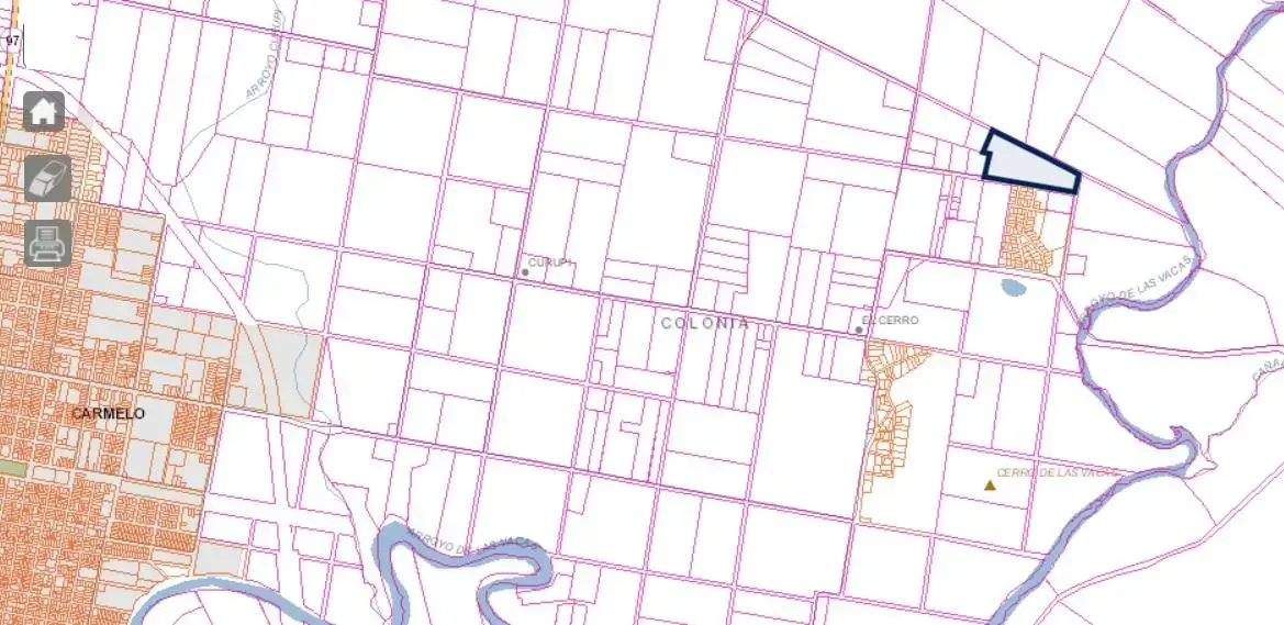
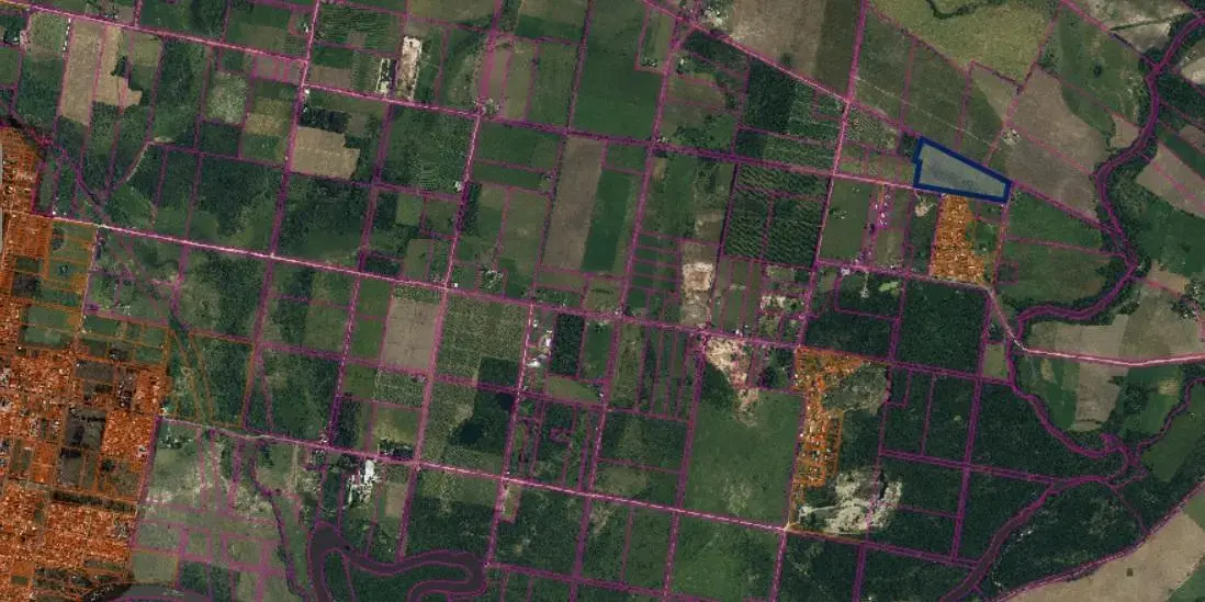
6.5-hectare farm in the Cerro Carmelo area

6.5-hectare farm for sale in the El Cerro Carmelo area, behind the MEVIR homes. It has potential to be subdivided into 1-hectare plots.

Sale price per hectare: USD 20.000
Ask about financing.

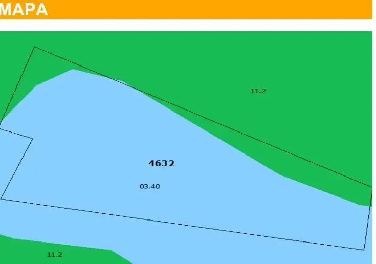
Soils:

11.2 It is located in the departments of Río Negro and Soriano and, to a lesser extent, Colonia. The geological material consists of silty sediments that cover the Fray Bentos Formation in thin layers; the materials originated from this formation and inherited its lithological characteristics. The relief is undulating (3 to 6% slope) to strongly undulating (5-8%); the latter occurs near the Uruguay River, where substantially steeper bluffs can sometimes be seen. The predominant soils are deep and moderately deep Typical Eutric Brunisols, very dark brown to black, with clay loam to silty clay loam texture, high to very high fertility, and moderately good drainage (deep and moderately deep Black Grasslands). On more convex slopes, associated shallow Typical Eutric Brunisols (Regosols) occur. In depressions, Solonetz occur in bands at the slope transition from convex to concave on the lower slopes, and Melanic Eutric Planosols occur in the central depression, usually with a gully. The predominant use is winter-summer crops and stubble. The natural grassland is dominated by winter species and is prone to invasion by espartillo grass and parkland vegetation, especially espinillos. This group corresponds to the Fray Bentos unit on the 1:1.000.000 map (D.S.F.).

03.40 This group corresponds to stream plains on the western littoral, such as the one along Arroyo Negro, within the Fray Bentos Formation regions, and is therefore found in the departments of Paysandú, Río Negro, Soriano, and Colonia. Some stream plains with similar characteristics in the department of Durazno, such as the one along Aº Villasboas, have also been included in this group. The geological material consists of silty clay sediments and alluvial sediments of variable, stratified textures associated with waterways. The plains have mesorelief. On the higher flats there is an association of Luvic Eutric Brunisols (maximum and planosolic Brown Grasslands), dark brown in color, with silty loam texture, high fertility, and imperfect drainage, and Ochric Solonetz, light grayish brown in color, with silty loam texture, very low fertility, and imperfect drainage. In depressed areas there are Typical Melanic Gleysols (humic Gleys) and, near waterways, Fluvisols (Alluvial Soils), usually with tree vegetation of the riverine forest type. The land is used for grazing, with parkland vegetation and trees of variable density. For scale reasons, this group is included in the Fray Bentos, San Manuel, and Young units on the 1:1.000.000 map (D.S.F.). Productivity Index 96.

Reference code: GCH7250991

If you are interested in the property, you can arrange a viewing by calling:

Sales: 099425417 (Martín González) / 099337795 (Carlos Véliz)

Our office is at Zorrilla de San Martín 447, corner of Roosevelt, Carmelo, Uruguay.

Property details

ID

Category

Type

Terrain

1228239

Farm or field

Sale

650002

Rooms

Code

Updated

1

Y8AED9

2025-08-26

Location

20к U$S

Location

Colonia

Address

Carmelo, Cerro Carmelo 6.5 Hectáreas

What's nearby

School
Escuela 51
450 m · 6 min walk

Straight-line distance, walking time at 4.8 km/h. Map data © OpenStreetMap contributors

Additional Actions

Gonzalez Veliz
099...417
598...417
Similar object
Loading...

Sponsored

Earn money by referring colleagues!

Invite other real estate agents and earn 10% commission for every promotion they make.